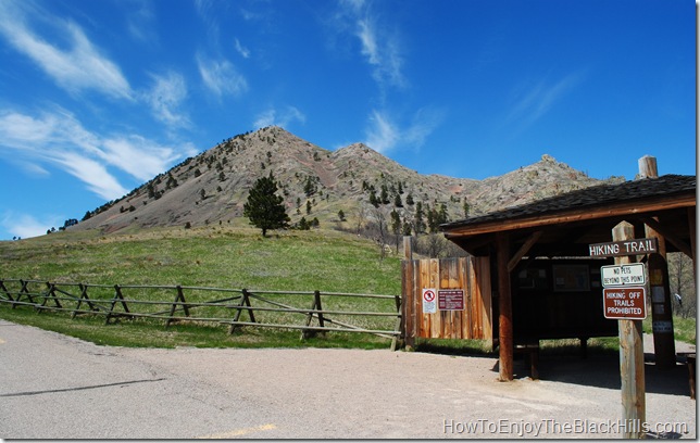
Bear Butte is the first trail I hiked when I moved to the Black Hills in 1999. I love the view from the top, The Black Hills to the south and prairie to the north. This two mile trail rises about 1000 feet in elevation and has loose rock in many places making this slightly strenuous for some people. Interestingly enough, Bear Butte is actually a mountain. It was once liquid magma that made its way to the earth’s crust, the formation is call a laccolith.
Bear Butte is located in Bear Butte State Park and if you do not have an annual pass, you will have to buy a day pass. The Lakota called it Mato Paha or Bear Mountain and is a sacred place to the Native Americans. You will see many prayer cloths and tobacco ties along the trail, please be respectful and observe them, not disturb them.
This is a narrow trail and for that reason pets and horses are not allowed. There is a small herd of buffalo in the park, be cautious and do not approach the buffalo. The area is also home to rattlesnakes, watch where you walk and stay on the trail.
The summit is the Northern end of the 111-mile Centennial Trail. The trail was built in 1989 celebrating South Dakota’s 100th anniversary of statehood. Winding through the Black Hills ending in Wind Cave National Park near Hot Springs, SD.
How do you get to Bear Butte?
It is located 6 miles northwest of Sturgis, SD. Head east out of Sturgis on Highway 34, Then turn North on Highway 79. Bear Butte will be visible, just follow the signs.
Visit the South Dakota G,F&P website for more information.
If you are going to by hiking in the area I would encourage you to carry a copy of Best Easy Day Hikes Black Hills Country and a good map such as Black Hills – Northeast, South Dakota 751
. Both are very helpful for navigating the trails of the area.
Have you made it to the top of Bear Butte?

https://waterfallmagazine.com
Wow, that’s what I was looking for, what a material! present here at this blog, thanks admin of this web site.
ggptwu
hptjqb
w72t2l
s7xk63
y17bnz